- Urban Design
- //
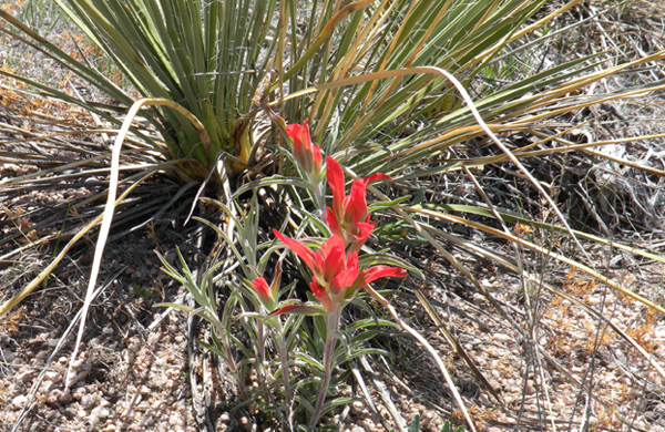
- Parks and Open Space
- //
- Gardens
- //
- Corporate & Public
- //
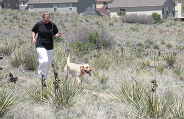
- Community
- //
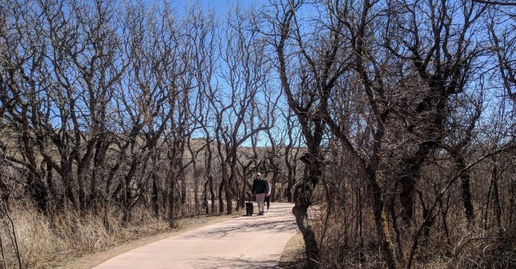
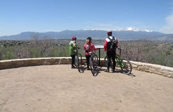
- Trails
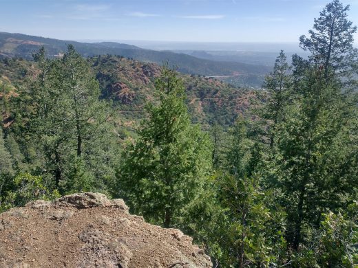
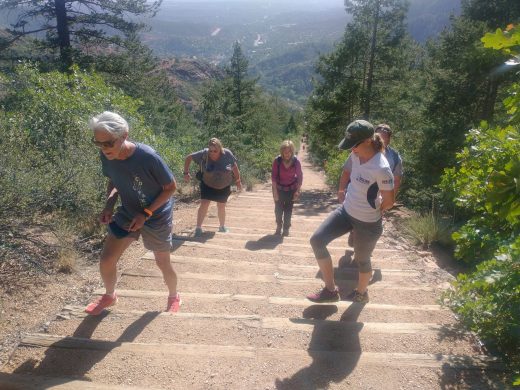
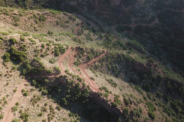
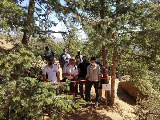
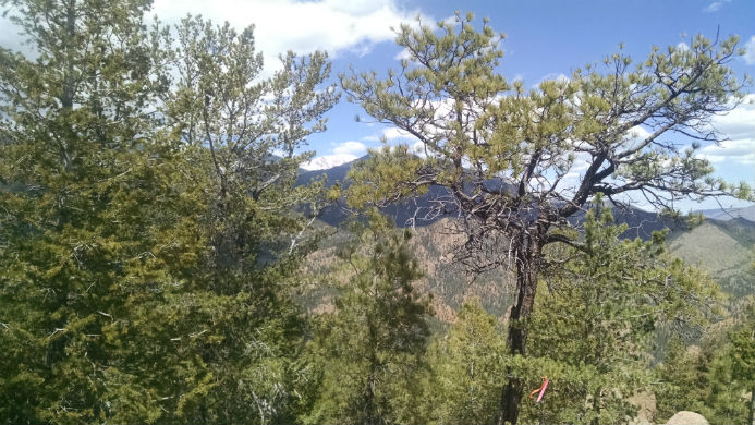
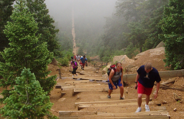
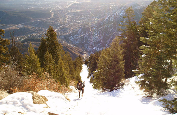
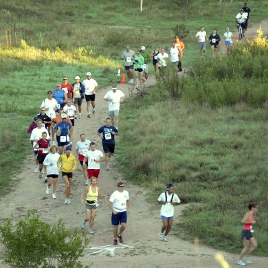
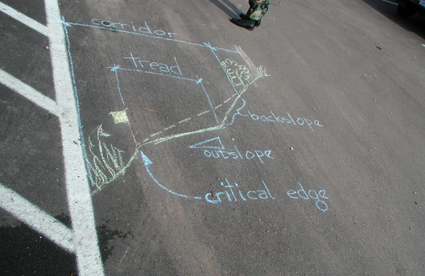
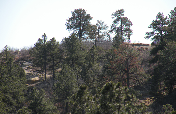
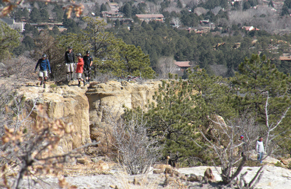
The Manitou Incline is located on the former trackbed of the Mt. Manitou Scenic Railway in Manitou Springs. In its one-mile length, the route climbs 2000 vertical feet, primarily on 2750 railroad tie “steps”. The North Trail, (recommended in the Tapis-lead Site Development and Management Plan) will provide an alternative route to and from the top of the Incline while distributing trips from the overcrowded Barr Trail. The 4.3-mile trail in extremely rugged terrain is designed (aspect, alignment, grades, corridor) to provide a multi-use route connecting the Inclines’ base to top and includes strategic-intermediate connections to the Incline.
Work included onsite route exploration, alternative route flagging utilizing a clinometer, recommended route flagging of the two miles not on USFS property, GPS mapping, presentation maps, route hikes with Client and stakeholders.
Prior Tapis projects influencing this work include: Manitou Incline Site Development and Management Plan (2011); and the City of Manitou Springs Parks, Open Space and Trails Master Plan (parks planner, landscape architect and trails specialist on team 2016).
Client: The City of Colorado Springs Parks, Recreation and Cultural Services
Location: Colorado Springs, CO
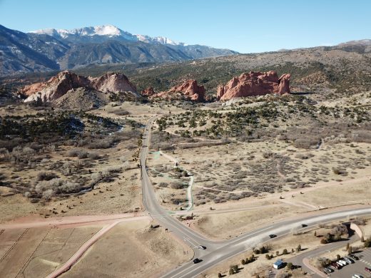
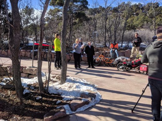
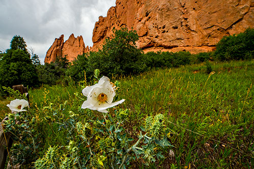
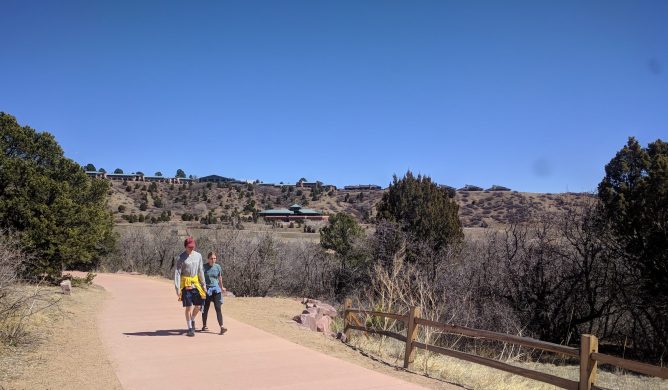
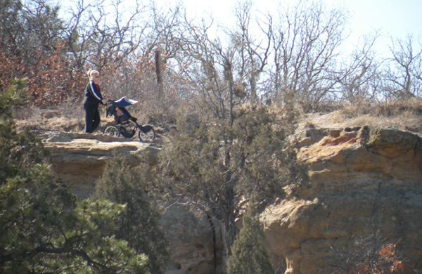
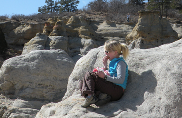
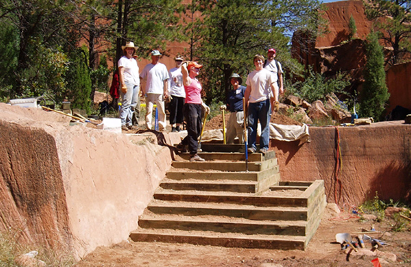
Garden of the Gods - ADA Accessible Gateway Trail
With dramatic views, towering cliffs, balanced rocks and snow-capped mountains in the distance, Garden of the Gods Park is a city park of extraordinary natural beauty attracting 2-million visitors per year. The Gateway Trail provides the vital, ADA accessible link between this extraordinary beauty, a new parking area and the Interpretive/Visitors Center.
Weaving through cactus, yuccas, prairie grass, mountain mahogany, and scrub oak and across Camp Creek, the Gateway Trail leads visitors to the foot of the famed geologic formations. Walkers, hikers and cyclists and equestrians share and enjoy this unique half mile journey.
Professional services included determination, evaluation and flagging of alternative trail alignments, site walk with park staff to determine preferred alignment, construction flagging, survey subcontract, coordination with bridge engineer, construction documents and specifications, and on-site observation.
Prior Tapis projects influencing this work include: Presentation on Carrying Capacity Protocols to Friends of Garden of the Gods Board of Directors (2018); Camp Creek Drainage Improvement Project and Garden of the Gods Detention Facility, Camp Creek Waterway Stabilization (landscape architect on team 2014-2018); Technical Advisor for VOC trail projects in the Garden (late 1990’s).
Client: The City of Colorado Springs Parks, Recreation and Cultural Services
Location: Colorado Springs, CO
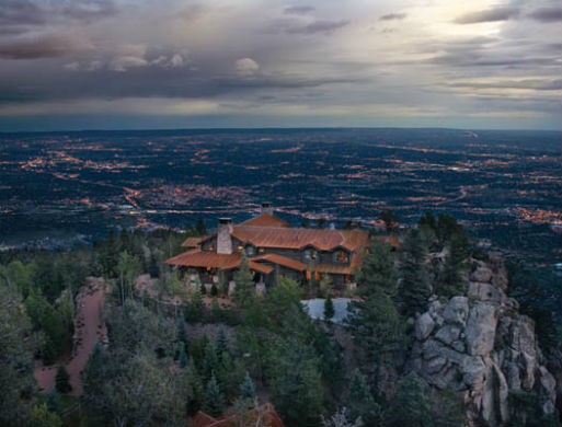
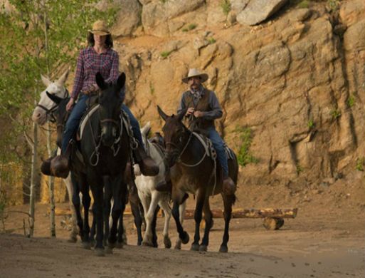
Broadmoor Wilderness Experience Trail System
Sitting at 9,200 feet atop Cheyenne Mountain is The Broadmoor’s newest wilderness experience, Cloud Camp. With unobstructed 360 degree views, the incomparable splendor of Colorado resides here. On the historic site of Broadmoor founder Spencer Penrose’s Cheyenne Lodge, this escape is meant to inspire and amaze.
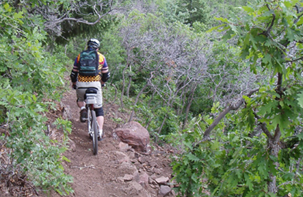
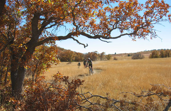
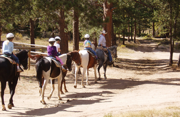
The Tapis designed trail system is a key amenity for Broadmoor guests and incorporates vigorous hiking trails, equestrian and mule trails, mountain bike trails, majestic view overlooks, connections to Pike National Forest trails, and leisurely trails to enjoy a glass of wine and enjoy a secluded overlook. The trail system also connects the splendor of the natural setting, historic settler sites and the luxury accommodations of the The Broadmoor's main resort, Cloud Camp, Emerald Valley Ranch and the Seven Falls 1858 Restaurant and Soaring Adventures zipline. The sustainable trail system, nestled within the extensive Broadmoor Wilderness Experience land holdings, provides recreational opportunities and connects resort amenities with an inspiring and sustainable trail system.
Tapis Associates' collaboration with The Braodmoor continues. To date Tapis has created a comprehensive trail system design, worked with client to establish multi-year construction priorities, evaluated existing private and public trails, field flagged and GPS documented sustainable trail corridor alignments, established sprinkler flagging for specific trail alignments prior to construction, participated in preconstruction walk thru with trail contractor, and coordination with trail map cartographer.
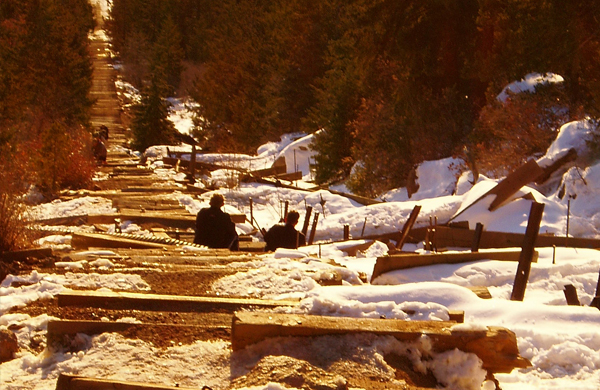
Manitou Incline Site Development & Management Plan
The Manitou Incline is located on the former trackbed of the Mt. Manitou Scenic Railway in Manitou Springs. In its one-mile length, the route climbs 2000 vertical feet, primarily on 2750 railroad tie “steps”. Despite being privately owned and posted “No Trespassing” the trail has grown in use and popularity to an estimated 350,000 or more user trips each year. Olympic athletes, troops from Ft. Carson, local fitness buffs, and tourists can be found on the steps year-round.
The Tapis Associates Team created a public-process driven plan to identify and address the wide array of physical, legal, social and economic issues that have stymied previous efforts to legally opening the trail. Interviews with corporate landowners, the US Forest Service and the cities of Colorado Springs and Manitou Springs were supplemented were supplemented by neighborhood and public meetings and were key to surfacing the project’s issues and interdependencies. The Tapis-led Team, included KezziahWatkins, GreenPlay, Wilson & Company, ERO Resources and Loris and Associates - all specialist firms.
The resulting plan addresses the critical issues pivotal to legally opening the Incline and managing ongoing operation. The Manitou Incline Site Development and Management Plan is organized into three flexible stages which build upon each other; it is structured to provide detailed guidance for this dynamic facility.
"Tapis Associates did an exceptional job with the public process and guiding the completion of the Manitou Incline Site Development and Management Plan." - Frank Landis, US Forest Service Ranger, Pike and San Isabel National Forests
The Tapis Team developed the Operational and Management Plan recommendations, including estimates of operating costs and detailed identification, projections and parameters of outside funding sources. The input facilitated decision-making efforts to help determine financial sustainability and potential revenue-generating activities for cost recovery.
Final approval of the Manitou Incline Site Development and Management Plan by both City Councils took place March 2011.
Landowners and significant stakeholders include: US Forest Service, Manitou and Pike’s Peak Cog Railway Company, Colorado Spring Utilities, the City’s of Manitou Springs and Colorado Springs, residents, local business community and diverse users from elite athletes to curious tourists.
Client: City of Colorado Springs Parks, Recreation and Cultural Services Location: Manitou Springs, CO
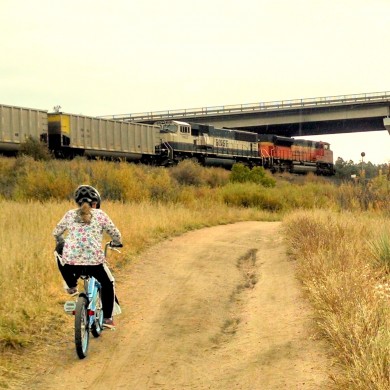
New Santa Fe Trail Assessment
El Paso County’s New Santa Fe Trail established a 6.9 mile link through the US Air Force Academy in 1988. Making use of abandoned rail corridor where possible, it forms a unique, varied and critical connection between the cities of Palmer Lake and Colorado Springs. The trail offers users grand vistas of Colorado’s Front Range and its wildlife while traversing meadows, riparian areas and forested glades. In addition to its recreational values, the New Santa Fe Trail forms the spine of the El Paso County trail system, makes an important commuter connection, and links Colorado’s Front Range Trail through northern El Paso County. Informal estimates set usage of the New Santa Fe Trail upwards of 100,000 visits per year.
Tapis Associates worked with El Paso County Parks to assess and document trail conditions, identify improvements and establish maintenance needs for the New Santa Fe Trail as it passes through the US Air Force Academy in El Paso County. The resulting report sets priorities for safety and usability improvements and maintenance needed for phased implementation.
Tapis continues to work with El Paso County Parks to establish construction cost estimates, specify details, stake worksite layout, assist with the bidding process and to observe contractor work for quality and progress.
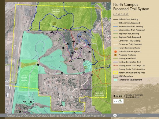
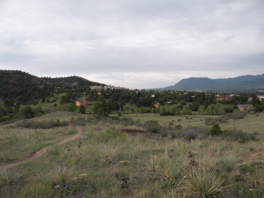
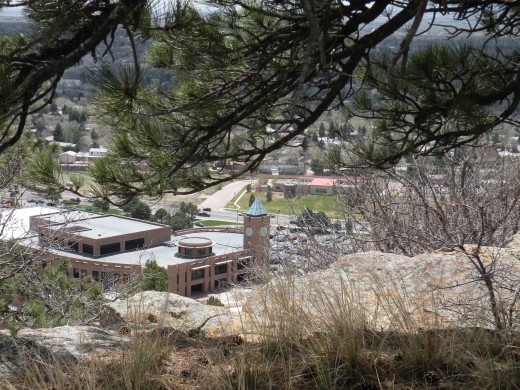
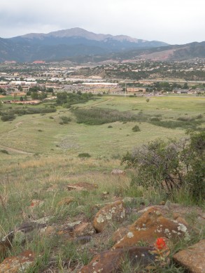
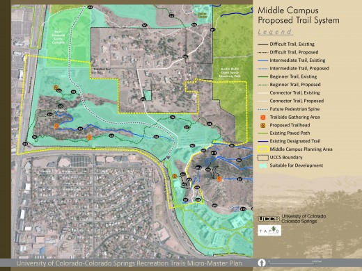
UCCS Recreational Trails Micro-Master Plan
The 2014 University of Colorado Colorado Springs (UCCS) Recreational Trails Micro-Master Plan provides a strategy for implementing a trail system that is both a recreational amenity and an alternative transportation experience. UCCS has grown steadily since its inception. The Recreational Trails Micro-Master Plan embodies these concepts set forth in the 2012 Campus Master Plan. The Campus Master Plan is grounded in the premise of "respecting the responsible capacity of the land" and supported by three design principles 1. Respect natural features, 2. Reinforce vibrant campus anchors, and 3. Connect campus destinations.
The Recreation Trail Micro-Master Plan planning process was a collaborative effort engaging individuals from departments across campus and guided by the Recreational Trails Advisory Committee.
The proposed UCCS trail system is both a recreation amenity and an alternative route for getting around campus. The system expands upon the current endemic routes, while repairing and rerouting trails to provide key connections while protecting the campus' cultural and natural resources. The proposed trail system will include a series of looped trails linking desired destinations on campus to surrounding public open spaces. The backbone of the trail system will be the extension of the Sherpa Trail from East Campus to the underpass at North Nevada Avenue. The system will include about 13.6 miles of varied-challenge-level trails, consisting of both existing and new trail segments.
Research, data and existing conditions were collected and documented to inform the plan. A variety of methods were used by the Tapis Associates team specialists to collect data including numerous site visits, stakeholder interviews, extensive conversations with campus faculty, staff and students, and review of previous resource studies. The inventory and analysis of existing conditions conducted as part of the 2012 Campus Master Plan were used as the foundation for this micro-master plan; the Tapis and ERO Resources site visits during this plan served to extend this body of knowledge on which trail planning decisions were based.
The UCCS Recreational Trails Micro-Master Plan envisions the campus as an area that offers all people the opportunity to experience this unique and beautiful place. The focus is on providing access through a variety of multi-use trails and the support facilities needed to serve them. The plan also allows for trail related trailside gathering areas, interpretive sites, trails with additional attributes for\sight impaired interpretation and designation of themed routes (e.g. curriculum based geology, biology, wellness, etc. and a cross country venue). Trailheads have also been identified at key connections to the system.
The micro-master plan also recommends approaches for integration with the UCCS experience, design guidelines for trails, functional guidelines for safety and signage, construction procedures, management considerations, natural and cultural resource protection, and phasing priorities, costs and implementation guidelines.
The Recreational Trail Micro-Master Plan is a specific yet flexible roadmap that will guide creation and maintenance of a sustainable trail system for the UCCS campus community.
Prior and follow-up Tapis projects directly related to this work include: UCCS Campus Master Plan (landscape architect on team 2012), Austin Bluffs Regional Trail alignment layout (2012), Technical Advisor for VOC trail projects in adjacent open space (2017).
Client: University of Colorado Colorado Springs
Location: Colorado Springs
High Chaparral Open Space Trail Design
After completing the resource management guided master plan for High Chaparral Open Space, the City retained Tapis Associates to design the major trail system.
Professional services included: trail design, project scoping, tools and materials calculations, and pre-project coordination with City representatives.
Client: The City of Colorado Springs Parks, Recreation and Cultural Services
Location: Colorado Springs, CO
Blodgett Open Space Trail Design and Volunteer Coordination
After completing the resource management guided master plan for Blodgett Open Space, the City retained Tapis Associates on three occasions to design major trails and supervise volunteer work groups to accomplish the work.
Professional services for these work days included: trail design, project scoping, tools and materials calculations, pre-project coordination with volunteer group representatives, pre-project crew leader training for selected volunteer group members, providing expert crew leaders, and project day leadership and technical direction including trail structure construction demonstrations.
Client: The City of Colorado Springs Parks, Recreation and Cultural Services
Location: Colorado Springs, CO
Palmer Park Technical Trail System Master Plan
With dramatic views, unique rock formations and snowcapped mountains in the distance, Palmer Park is a nationally recognized hiking, mountain biking and equestrian trail destination. The Trails Master Plan emphasizes preservation and enjoyment of the park’s natural beauty while minimizing adverse interactions between the diverse trail users.
“...the land shall be kept and maintained as a park, so far as possible in the condition in which nature has fashioned it...” - Palmer Deed 1902
Recommendations for the over 600 acre City of Colorado Springs natural park trail system were completed in conjunction with the 1997 Park Master Plan. Recommendations included integrating ecological preservation with the existing and new trail system requirements, trail system organization, trailhead designation, trail connections and closures, wayfinding system, trail user conflict mitigation, and maintenance and construction priorities
Professional services included trail master plan as described above and its presentation at public meetings. Tapis Associates also coordinated and facilitated the City technical staff throughout the park master planning process, serving as liaison between the City’s technical planning team and the public process facilitation consultant.
Client: The City of Colorado Springs Parks, Recreation and Cultural Services
Location: Colorado Springs, CO
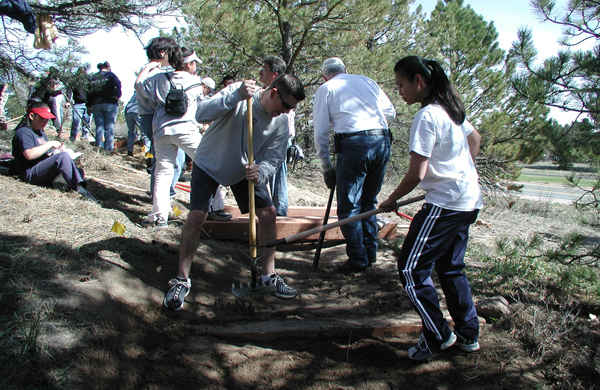
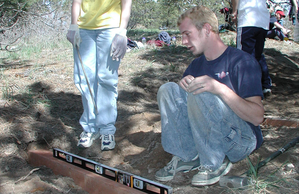
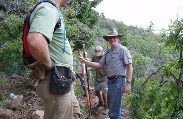
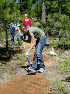
Volunteer Training and Leadership
To study and learn all about conscientious and sustainable trail design and construction is fulfilling, but to share that knowledge is truly where we manifest and expand our dream of caring for our wildlands.
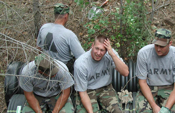
Tapis Associates has an ongoing relationship with the City of Colorado Springs coordinating and leading volunteer groups for trail construction workdays. We have lead varied groups from Fort Carson battalions, USAFA cadet wings, corporate groups, and volunteers brought forth from the local REI retail store.
Professional services for these work days have included: multi-use trail & trailhead design, project scoping, tools and materials calculations, pre-project coordination with volunteer group representatives, pre-project crew leader training for selected volunteer group members, providing expert crew leaders, and project day leadership and technical direction including trail structure construction demonstrations.
“The public image of public lands is an essential dimension of encouraging the public to care about and use parklands well….. If the wrong image is presented and the wrong kind of development occurs, people don’t care as much.”
- Ethan Carr, historical landscape architect for the NPS
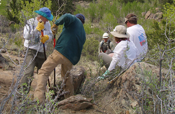
Volunteers for Outdoor Colorado (VOC) is a non-political, non-profit organization which fulfills its mission of instilling stewardship for our public lands by conducing and promoting volunteer outdoor work projects and by training individuals who will be able to increase the impact of VOC by catalyzing volunteers efforts in the future.
“...the mission to instill in Colorado residents a sense of personal responsibility for their public lands resulting in beneficial stewardship of the state’s natural resources.”- VOC Crew Leader Manual 1992
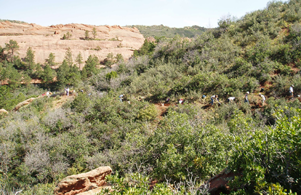
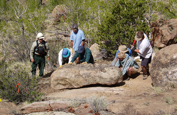
Ms. Marbaker is actively involved with VOC as a Technical Advisor. In this role she is responsible for the design, planning, agency coordination, documentation and supervision of trail construction and revegetation by volunteers. Projects include: Black Forest Regional Park—100 volunteers, 1 day; Fourmile Recreation Area—150 volunteers, 2 days; Red Rock Canyon Open Space—160 volunteers, 2 days; Cheyenne Mountain State Park Zook Trail—200 volunteers, 2 days; Eleven Mile State Park—180 volunteers, two days; Catamount Lakes—250 volunteers, 3 days; Josephine Lake—50 volunteers, 3 days; Intemann Trail—180 volunteers, 2 days; and Garden of the Gods—250 volunteers, 2 days.
Ms. Marbaker also serves as a Crew Leader on several trail projects each year, directing a crew of 5-7 volunteers.
Clients: US Air Force Academy, Colorado State Parks, United States Forest Service, Intemann Trail Committee, Town of Green Mountain Falls, and The City of Colorado Springs Parks, Recreation and Cultural Services
Location: State of Colorado
Ring the Peak. Teller County, El Paso County and the Pike National Forest, CO
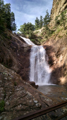
North Cheyenne Cañon Park's Ladders (of Chutes and Ladders), Gold Camp Path, Creekside Trail, Silver Cascade Falls Loop Trail, and the Chamberlain Trail on Strawberry Hill. Colorado Springs, CO
Black Forest Regional Park Technical Trails Evaluation.
Black Forest, El Paso County, CO
Red Rock Canyon Open Space's Contemplative, Quarry Pass, RoundUp, White Acres, Chamberlain and Red Rock Canyon Overlook Trails. Reroutes include Waterfall, Inteman and Parallel Trails. Colorado Springs, CO
Pineries Open Space Trail System Plan. El Paso County, CO