- Urban Design
- //
- Parks and Open Space
- //
- Gardens
- //
- Corporate & Public
- //
- Community
- //
- Trails
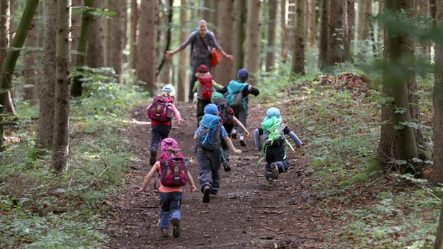
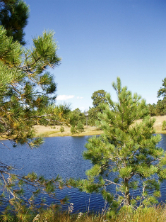
This Master Interpretive Plan lays the foundation for the Northern Nature Center development. As a decision-making tool, it establishes the Northern Nature Center in Fox Run Regional Park’s (FRRP) interpretive focus and envisions an engaging visitor experience. The Master Interpretive Plan will shape the site, building and interpretive methods as the Nature Center becomes reality.
This Master Interpretive Plan offers key concepts and a structure that is designed to spin a web of connections for the visitor between what they are seeing in the Park and Nature Center, and their own experiences and lives. The more connections visitors can make to the stories portrayed in the Northern Nature Center in FRRP, the more often they will want to visit and become engaged.
Following COVID-compliant interviews and worksessions, Tapis Associates created the custom Integrated Planning Framework that organized the Plan. The Master Interpretive Plan was shaped by the Interpretation Goals, Visitor Experience Goals and Resource Protection Goals.
“Through interpretation, understanding;
through understanding, appreciation;
through appreciation, protection.” - National Park Service Administrative Manual
The thematic framework outlines the key stories or concepts that visitors should understand after visiting The Northern Nature Center in FRRP. The thematic framework designates overarching themes, sub-themes, and storylines to be presented in the Nature Center and extended out into the landscape surrounding it. The Central Themes provide the foundation for all interpretive programs and media. Subthemes and Storylines zero-in on specific aspects of the general concept, and add texture, explanation, perspective, and detail. The six Central Themes include:
The Master Interpretive Plan offers recommendations and methodologies for storytelling, creating meaningful visitor experiences and resource protection and stewardship. The resource protection recommendations are categorized by application to operational considerations, site development considerations and building design considerations.
This Plan also lays out a series of suggested next steps to direct fundraising, design, and developmental efforts.
Client: El Paso County Community Services, Parks and Recreation
Location: Black Forest, CO
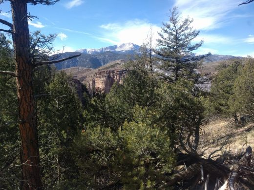
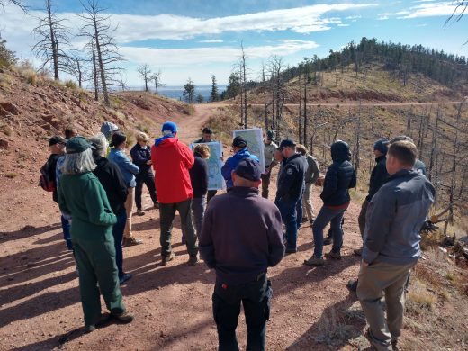
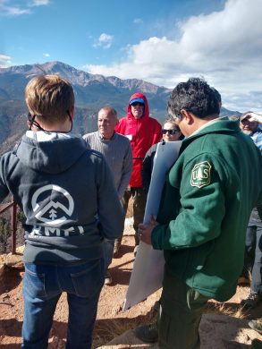
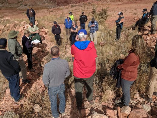
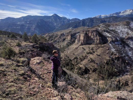
Tapis Associates designed, facilitated and documented a public planning engagement process for Waldo Canyon. The customized approach included a collaborative effort with the Partners (RMFI, TOSC, COS and the USFS) anchored by a transparent public engagement that invited participation, drew in the community, gave voice to all stakeholders and built trust between the Partners, Roundtable representatives and the areas’ recreational users and community. While increasing trust and consensus, this approach also built a complete and nuanced understanding of the property, corridor users and corridor uses—all of which informed and supported the resultant recommendations report.
Prior Tapis projects influencing this work include: Jones Park Trail Decommissioning for the Protection of Greenback Cutthroat Trout (2017); Ring the Peak – Governor’s 16 in 2016 (trail-lead on team 2018); Blodgett Open Space Master Plan (2002).
See the Re-Imagine Waldo Canyon Report at https://www.waldocanyonplanning.com/news
Client: Rocky Mountain Field Institute - RMFI
Partners: Pike National Forest District - USFS, Trails and Open Space Coalition - TOSC, and the City of Colorado Springs - COS
Location: Pike and San Isabel National Forest, CO
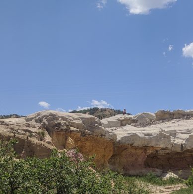
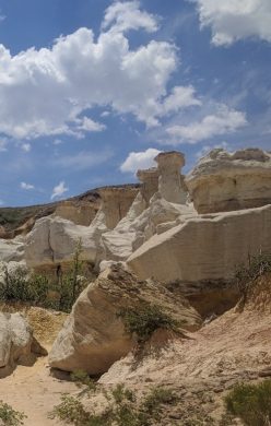
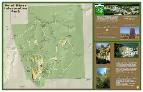
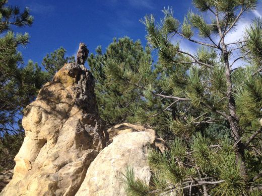
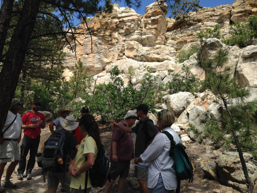
Tapis Associates worked with El Paso County Parks to assess the signage in the Paint Mines Interpretive Park and to create a framework for future signage design and messaging—how best to tell the story of the Park and generate a stewardship ethic in Park visitors.
Tapis worked closely with the client to define an achievable scope consistent with the client’s limited budget and created a signage strategy with the objective to:
The resulting signage strategy can meet the goals, target certain areas and, at the same time, be minimized in the park as a whole. In this targeted study, Tapis developed:
The strategy included recommendations for Trails and Interpretation. Trail recommendations included add trail connections desired by visitors, initiate deliberate social trail closure, restoration, temporary barbed-wire fencing and interpretive signage about restoration, and schedule regular routine trail maintenance to address erosion and social trail development. Interpretation recommendations included assign interpretive staff on site, consider occasional sheriff presence with interpretive staff and design, and hold interpretive programs on site.
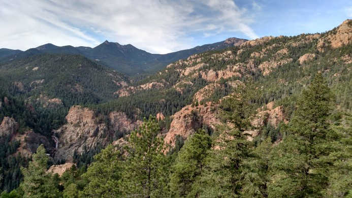
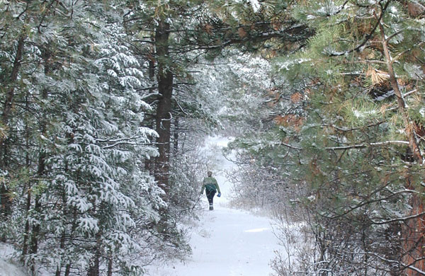
Client: El Paso County Community Services, Parks and Recreation
Location: Western El Paso County, CO
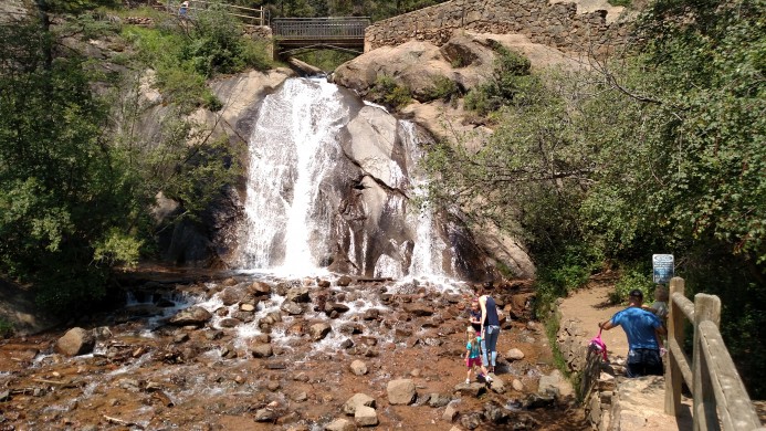
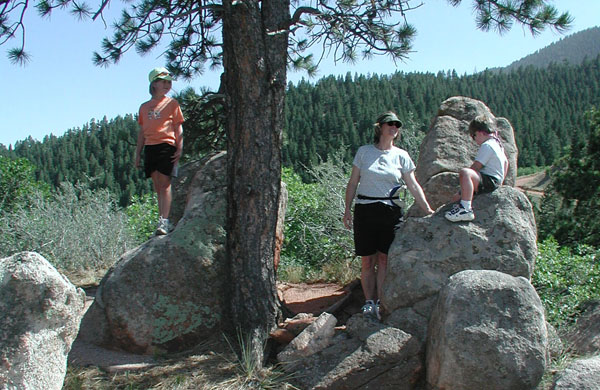
In 1969, Ute Valley Park was donated to the City. Over the decades, additional parcels have been dedicated and acquired through the City's Parkland Dedication Ordinance, expanding it to 338 acres. A master plan for the original portion of Ute Valley Park was completed in 1991. In 2013, 200 acres of the Hewlett-Packard property was purchased with a combination of private funding, a Great Outdoors Colorado (GOCO) (Lottery) grant and Colorado Springs' Trails Open Space and Parks sales tax (TOPS) funding. These properties contain significant natural, historical and cultural resources that merit protection and preservation. Heavily used by neighbors and the community, visitors enjoy a variety of activities including hiking, dog-walking, mountain biking, sight-seeing and quiet reflection.
The City of Colorado Springs Parks, Recreation and Cultural Services Department hired the Tapis Associates Team to prepare this Master and Management Plan. This Master Plan will cohesively guide future site and trail development, to protect the natural environment while meeting the needs of the public. The Management Plan establishes recommendations for preservation and protection of sensitive resources, restoration of damaged resources, park influences on surround residential neighborhoods and the management of all natural resources and developed facilities.
As part of this process, ERO Resources has completed habitat inventories, habitat fragmentation trail analysis, and cultural inventory and assessment. ERO worked closely with the planning team and the community to develop a plan that balances trail access and connections with resource conservation in a manner that is ecologically and financially sustainable.
Wilson & Company's assessment of the main drainage traversing the Park guided alignment alternatives and resource recommendations for the paralleling regional trail. Working closely with the team, Wilson created detailed stabilization and restoration recommendations for the multiple reaches along the drainage.
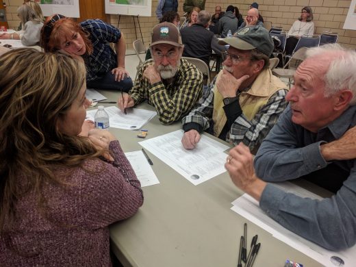
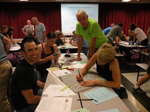
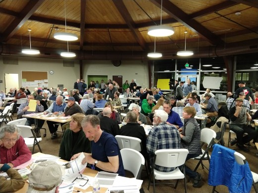
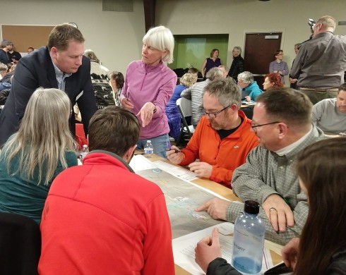
KezziahWatkins designed and facilitated the public process for development of the Master Plan. Almost 250 people participated in the process, with many of those people attending multiple meetings. Decisions were made cumulatively through "meetings-in a box," onsite parking and intercept surveys and public workshops during which participants defined goals for the Plan and worked in small groups to produce site plans for trails and other uses. The consistencies and interesting ideas contained in those site plans served as the foundation for the concept plan developed by the planning team and recommended plan development.
The Ute Valley Park Master and Management Plan was approved in Spring of 2015 by the Colorado Springs Parks, Recreation and Cultural Services Advisory Board. Tapis continues to work with the Parks Department as the master plan recommendations are implemented.
This community-created plan continues to guide the future of this spectacular public park and open space.
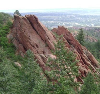
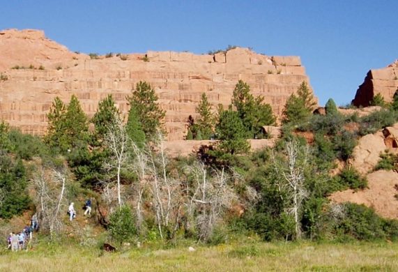
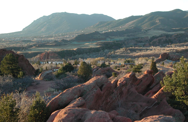
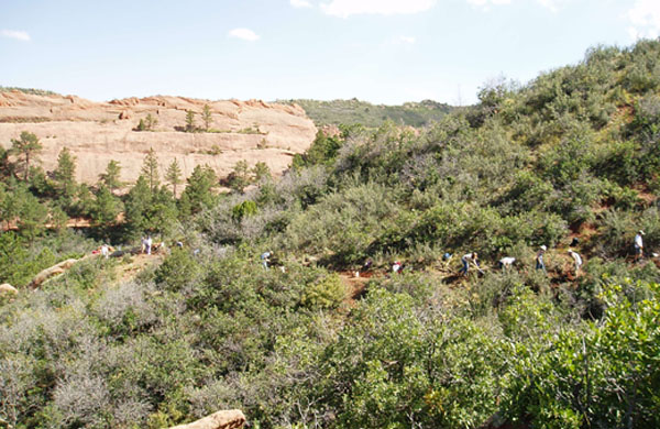
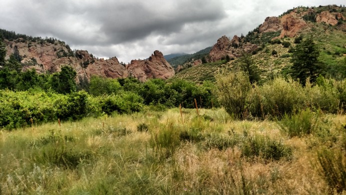
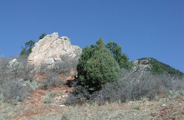
Collectively Red Rock Canyon Open Space, Section 16 and White Acres form one of the most beloved open spaces within the Colorado Springs park system. These properties contain significant natural, historical and cultural resources that merit protection and preservation. Visitors enjoy a variety of activities including mountain biking, rock climbing, sight-seeing, hiking, picnicking, horseback riding and meditating.
The City determined that natural resource management and public access could be most effectively balanced by managing the three properties as one combined open space called Red Rock Canyon. The Red Rock Canyon Open Space Master and Management Plan integrates technical knowledge into the community fabric of Colorado Springs creating and protecting an area that offers all people the opportunity to experience this unique and spectacular public open space.
As a community-developed plan, public participation was an integral foundation for the Red Rock Canyon Master and Management Plan . Reaching beyond soliciting public opinion, the Tapis Team strived to develop informed public judgement through information and deliberation. The design and facilitation of the public process revealed and resolved issues and conflicts via an open, transparent process, combining the experience and opinions of open space users with the technical expertise of the City staff and the consultant team.
Through careful site assessment, the Tapis Team inventoried physical resources, biological and cultural resources, and management and social influences to inform the formation of the Master and Management Plan. Developed with community input collected in surveys and public meetings, The Master Plan focused on providing access to a variety of outdoor experiences in the open space including multiuse trails accommodating a wide range of abilities and interests, technical rock climbing areas, a free-riding course for cyclists, an off-leash dog area, interpretive sites and outdoor event facilities. Refined concurrently, the Red Rock Canyon Open Space Management Plan emphasized natural and cultural resource protection and restoration, while accommodating sustainable recreational and interpretive opportunities. Annual monitoring and reporting by the Palmer Land Trust are mandated in the conservation easements, ensuring consistent, long-lasting stewardship for the property.
The Red Rock Canyon Master Plan and Management Plan is the first jointly developed master and management plan the City of Colorado Springs had undertaken and has served as a model for future plans.
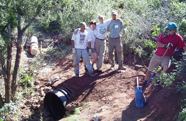
Prior and subsequent Tapis projects related to this work include multi-use trail design and alignment flagging for Red Rock Canyon Contemplative, Quarry Pass, RoundUp, White Acres, Chamberlain and Red Rock Canyon Overlook Trails. Reroutes include Waterfall, Inteman and Parallel Trails (2004 to 2019); Red Rock Canyon Master Plan (trails specialist on team 2004); Technical Advisor for VOC trail projects in Red Rock Canyon.
Client: The City of Colorado Springs Parks, Recreation and Cultural Service
Location: Colorado Springs, CO
Award: Partnership for Community Design Award 2005
North Cheyenne Cañon Park Master and Management Plan
Since its purchase in 1885, North Cheyenne Cañon Park has served as a mountain retreat that residents love for its rugged rock formations, peaceful forested beauty and captivating views.
The Master Plan for North Cheyenne Cañon Park envisions an area that offers all people the opportunity to experience this unique and beautiful place. The focus is on providing access through a complementary system of roadway/parking facilities, a variety of multi-use trails, and the support facilities needed to serve Park visitors. Facilities and trails throughout the Park have been planned to accommodate a wide range of abilities and interests, and to offer a variety of experiences that make multiple visits worthwhile. Park use areas, trailheads, vehicle parking, and wayfinding nodes have also been identified and located in the Park.
As project lead, Tapis was responsible for planning, analysis and understanding the people who use and visit the park. These inputs produced the Master and Management Plan that is responsible and responsive for the client. The Master Plan strikes a balance between the need to protect and maintain the Park’s historic and natural resource integrity with the need to serve the ever-expanding base of current and future users. As a sub-consultant to the Tapis Team, Root House Studio completed onsite interviews which they integrated into planning-process promotional videos, visitor center assessments and recommendations, and interpretive exhibit recommendations.
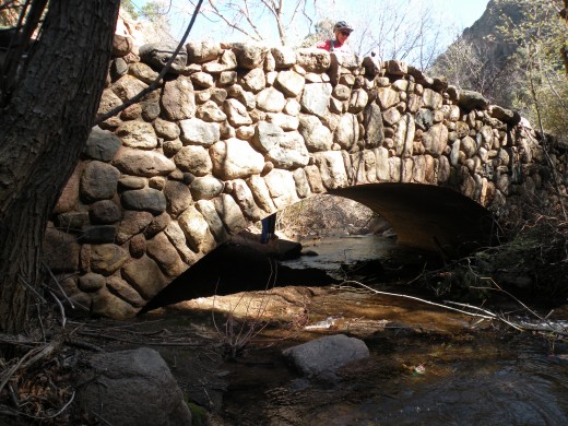
Follow-up Tapis projects resulting from this work include: Historic Bridges Replacement (landscape architect and public process on team 2017-2020); On-site multi -use trails and downhill mountain bike trail design, flagging and mapping (integrates existing trails with sustainable connections and recommends trail closure and restoration 2019); Technical Advisor for VOC project in park (2018).
Client: The City of Colorado Springs Parks, Recreation and Cultural Services Location: Colorado Springs, CO
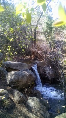
Blodgett Open Space Master Plan
Year round flowing water secures the Blodgett Open Space’s unique spot in the Colorado Springs Open Space system. Located at the foot of the Front Range, its riparian ecosystems thread through 167 acres of douglas-fir, ponderosa pine, and foothills shrubland vegetative communities. Mountain backdrop priority, dramatic views, cultural ruins and numerous rock formations add to its natural beauty.
“…The ultimate test of a man’s conscience may be his willingness to sacrifice something today for future generations whose words of thanks will not be heard.” - Gaylord Nelson – Founder of Earth Day
The resource management guided Master Plan balances resource conservation with visitor recreation and interpretive opportunities. Recommendations included minimizing future resource degradation through systematic trailhead design, integrating ecological preservation with the existing and new trail system, and formalizing agreements with adjacent land users to avoid future degradation and restore natural resources.
Professional services included visioning, goal setting, Pike National Forest access and interface negotiations, open space and trail system master planning, implementation priorities, and master plan document writing and design. Tapis Associates worked closely with our environmental consultant on resource inventory and analysis including wildlife threatened species.
Client: The City of Colorado Springs Parks, Recreation and Cultural Services
Location: Colorado Springs, CO
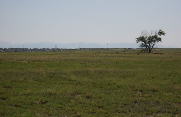

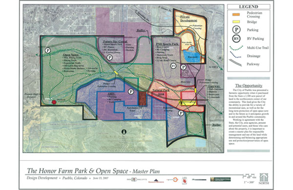
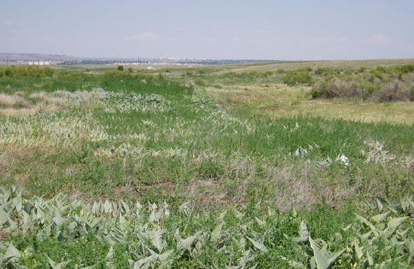
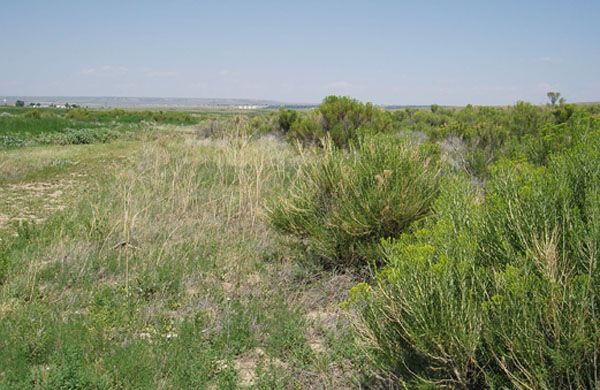
Pueblo's Honor Farm Park and Open Space
Honor Farm’s short grass prairie with rolling arroyos, sandstone cliffs and open lands create a broad 2,373 acre transition between the Cities of Pueblo and Pueblo West and Lake Pueblo State Park. Historic unfettered motorized access made Honor Farm a regional ‘open-ride’ destination, but has scarred the landscape.
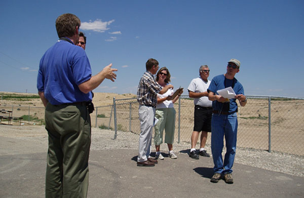
The eighteen-month public process, which included a 12 member Advisory Committee, strove for consensus between divergent agendas. Residents of the area and interested parties were welcome and encouraged to participate in this master plan process.
The resource management and public process guided Master Plan balances resource conservation with the divergent views and priorities of both users and governmental jurisdictions. The master plan includes the designation of different park and open space uses of the property, a plan for the realignment of the park boundaries to allow for the acquisition of the privately owned in-holdings, the general location for future roadways connecting Pueblo West and Pueblo Boulevard, a project implementation plan and schedule, projected costs for park and open space improvements, a budget projection for operation and management, and operation and management recommendations. The master plan specifically calls for control and regulation of the ‘open-riding’ motorized access to allow restoration of the damage ecosystems and designated space for passive and active recreation.
The public process strove for consensus between groups and individuals concerned with divergent agendas:
- off-road open-ride motorized access - hiking - non-motorized use & safety - equestrian - mountain biking - bird watching
Long term property lease holders: Pueblo Motorsports Park (710-acres) and the Sky Corral Model Airplane Club (60-acres)
Jurisdictional viewpoints included: City of Pueblo, Pueblo West, Pueblo County State Parks and local and regional utility companies
Professional services in collaboration with Design Concepts included public meetings; Advisory Committee meetings; visioning; goal setting; resource evaluation; park, open space and trail system master planning; implementation priorities; and City Council presentations.
Client: The City of Pueblo Department of Planning and Community Development
Location: Pueblo, CO
El Centro del Quinto Sol, Pueblo, CO
Santa Fe (previously Elephant Rock) Open Space Resource Assessment and History Report, Palmer Lake in El Paso County, CO
Kane Ranch Open Space Master Plan, El Paso County, CO
El Paso County Parks Master Plan, El Paso County, CO
City of Manitou Springs Parks, Open Space and Trails Master Plan, Manitou Springs, CO
Pineries Open Space Master Plan, Multi-Use Trail System Plan, Black Forest, El Paso County, CO
High Chaparral Open Space Master Plan, Colorado Springs, CO
Pulpit Rock Open Space, Colorado Springs, CO
Palmer Park Master Plan, Colorado Springs, CO
Fred McKowen Park, Colorado Springs, CO
Discovery Park Renovation, Colorado Springs, CO
Air Force Academy Sports Complex Conceptual Plan, USAFA, CO